Greetings from the land of green lawns and overpriced burgers and cokes (also known as Felix Unite’s Camp Provenance).
Yes, against small odds the SENQU2SEA team has made it to Noordoewer after several days in the rocky wasteland west of Augrabies Falls.
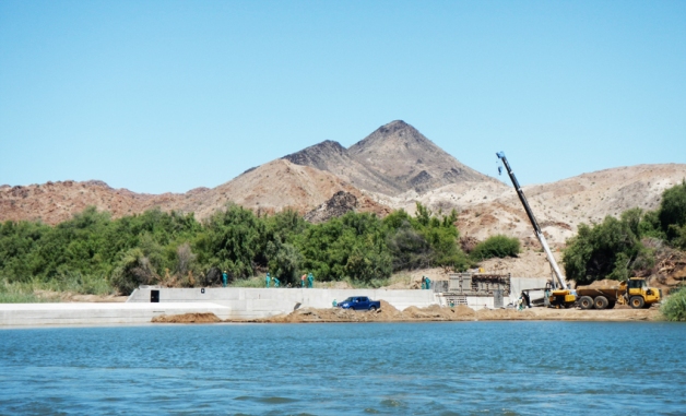
Damming of the !Gariep continues; this nasty looking weir (for fish and kayakers) under construction at the Blouputs bridge.
Park Manager at Augrabies, Frans van Rooyen, put together a small team to assist us with the portage to Echo Corner which was greatly appreciated.
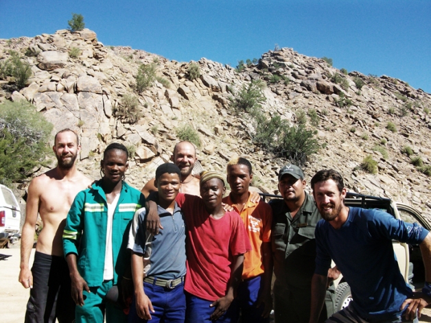
The South African National Parks team who helped us portage into the Augrabies Gorge at Echo Corner. Thanks Mario and team, you guys are legends for helping us carry such heavy loads!
Dropping into Echo Corner was like entering another world. After many days of paddling in a more or less flat landscape frequently surrounded by vineyards we were suddenly flanked on both sides by steep granite cliffs and an almost total lack of vegetation. The drop in altitude and parabolic effect created by the surrounding mountainsides caused temperatures to soar even higher than we had experienced at the Augrabies Restcamp, making shade a vital ingredient in the selection of campsites.
While the mountain slopes have become more barren, the river remains a ribbon of life and James’s intuition about the profusion of insect life in the hotter, drier environment was spot-on when we chose to camp in a seemingly idyllic dry tributary one evening. Within the space of half an hour several solifuges and scorpions had been spotted and okes were swiftly making all sorts of ingenious barriers at the borders of their groundsheets to keep the wildlife at bay. Sam’s construction clearly had a design flaw, resulting in a spider bite, but luckily with no lasting ill effects.
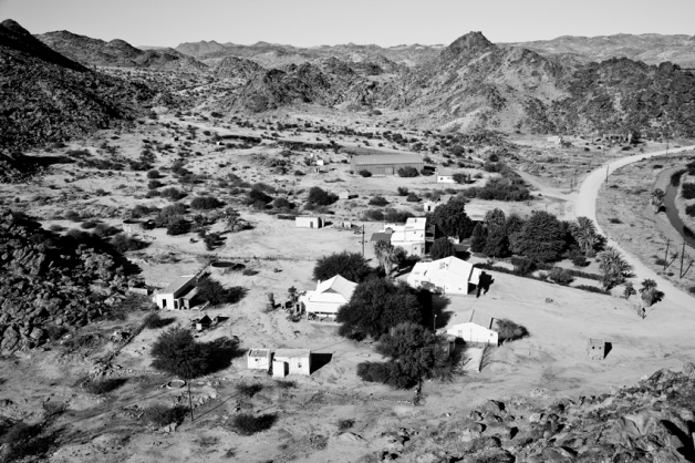
Isolated supply store outside Onseepkans. Sam was on resupply duty this day and ended up sitting outside the store for two hours waiting for them to open before a passer-by informed him that the shop would be closed for the day…next shop?…10 km away, on your bike son.
After 3 days of wilderness paddling we reached the small border outpost of Onseepkans and camped at the Gravity Adventure campsite despite finding no-one in attendance (being river people, we were sure they wouldn’t mind ☺).
We met Alex – a local river guide – the following morning and he provided some valuable info on the rapids above and below Ritchie Falls, which lies just a few kilometres downstream of Onseepkans. Meanwhile Sam received an exhilarating lift to the Onseepkans Mission village with Alex’s friend Anthony, who clearly had rally driving ambitions in his partially inebriated state. Then it was off again into even more remote terrain to the west.
The key to not dying at Ritchie Falls is to get out of the water quickly if one is unfortunate enough to capsize at the smaller Klein Valle, which precedes the main falls.
And this is exactly what Ian did with the help of some towage from Sam! The only thing that ended up being sacrificed to the falls was one of Sam’s slops (read: James’s father’s slops…sorry about that!).
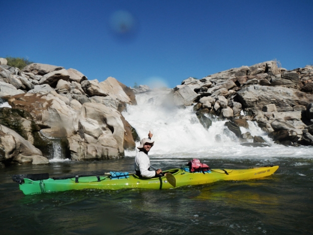
One of James’s PhD supervisors had informed him to watch out for Ritchie Falls because if he went over he would definitely DIE. When he saw it for himself in real life he had to wholeheartedly agree.
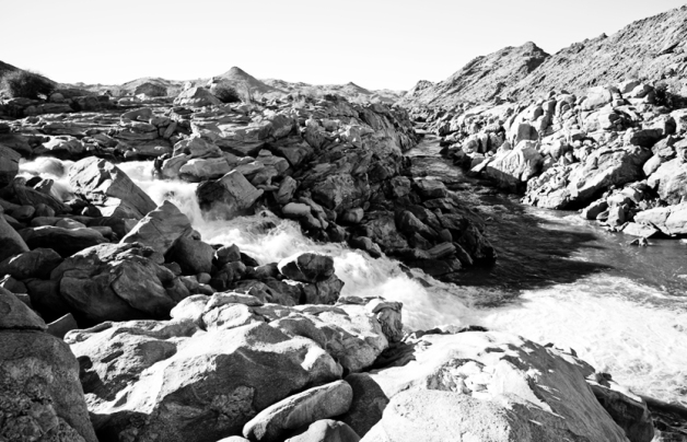
Ritchie Falls is a truly impressive sight. From the larger right hand channel which we had paddled, a maelstrom of water cascades, sucks and boils down a steep, polished rocky chute. Much of the water is actually transported below the surface layer of rocks in enormous siphons and potholes worn in the bedrock over the aeons. Definitely a portage! Equally impressive is the deep gorge formed by the left hand river channel, which meets the right hand channel at the bottom of the falls. This too has been beautifully sculpted and polished by the water over time.
We chose to overnight at Ritchie Falls in order to make the portage around the falls easier in morning coolness. Despite this forethought, we were still sweating heavily by the time the boats were in the water the following morning. This particular portage is a careful operation, as the kayaks need to be lowered down a section of steep, smooth granite, before being hauled to the waters edge.
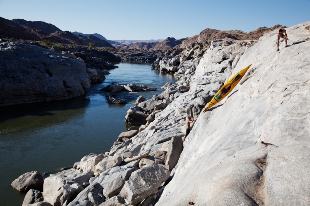
Sam and Ian applying some of their climbing skills with some nifty rope work to get the kayaks down the side of the gorge at Ritchie Falls.
Two big rapids follow shortly after Ritchie Falls: Big Bunny and Dolly Parton. On inspection both appeared less intimidating than we were expecting (probably because of higher than normal water levels) but by no means push-overs.
A big hole guards the bottom of Big Bunny and it’s almost impossible to avoid as a large, fast and very powerful wave-train pushes one straight in that direction. Despite this, the team all made it through with flying colours, James even stopping for a bit of nonchalant wave-riding in the hole before deftly grabbing his blue foamy which had been torn free from his boat by the water. He was less lucky at Dolly, which has a deceptive rip in its hole. Ian and Sam fortunately made it through unscathed, Ian with particular finesse, having been told to gun it through with some speed!
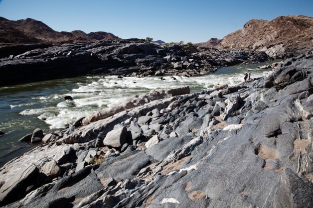
Ian: It looks pretty “bony” down the left there, hey boet.
Sam: Ja no look china, there’s a nasty “siphon” down there too, I skei “a boof stroke off the tongue” down the right line is the go on this one maboet.
Below these rapids the temperature seemed to kick up a few more notches, sending Game consumption levels through the roof and us scurrying for shade whenever out of our boats. At this point the remoteness of the area really dawned on us, with few access points marked on the map and miles of jagged peaks on all sides. From this point on, all the way to Vioolsdrif the mountain slopes seemed to be scorched and tortured by the sun’s white heat, radiating it during the afternoon and creating oven-like conditions, with the notable inclusion of the oven’s fan also running. These were possibly some of the hottest conditions of the entire journey and we found it almost impossible to relax or cool off. A dip and a wet sarong provided only temporary respite.
We passed the impressive Groot Pellaberg at whose foot lies the tiny historical mission station of Pella some distance inland.
Downstream we came across the extensive date plantations at Klein Pella where the harsh conditions in this area are ideal for growing this hardy crop. Below the Pella region the river plain widens and flattens, becoming a myriad of braided channels separated by reed, rock or tree-lined islands. Some carry one all the way through to the other side, most pinch out as the water seeps slowly through the reeds to rejoin larger channels. Within these channels lie Kum-Kum Falls, a feature we were looking to avoid by keeping river right. But a slight error in channel selection early on led to over an hour of bumping, scraping and thrashing our way through narrow, shallow channels, overtopped by reeds and thorn trees. Some would say we got off lightly! A GPS track is certainly beneficial in navigating these channels, but they change with changing water levels, so it’s by no means a perfect solution.
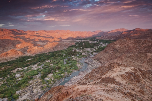
The !Gariep is an artery of green running through the harsh, arid and rugged landscapes on the border of Namibia (on the left). This particular stretch is where we battled our way through the many narrow channels in an effort to avoid Kum Kum Falls.
Braided channels continue all the way to the western end of the small communal farming settlement of Witbank. Every now and then we would see a small kraal or cattle outpost on an otherwise stark mountainside, probably used on a seasonal or rotational basis (we saw very few people). There certainly doesn’t seem to be enough vegetation on the slopes to support viable livestock farming, and most animals we saw were grazing within the riparian zone along the rivers edge. This was invariably dominated by Prosopis trees which, depending on one’s viewpoint, one can either see as a pest species competing with indigenous vegetation, or a valuable source of fodder, shade and wood.
Some distance after Witbank comes the settlement of Goodhouse, the location of an old ferry crossing (the ferry is still there but looks to be out of use) and apparently where the highest average temperature for South Africa is recorded. A small but thriving farming community is situated on the Namibian side where crops are irrigated during summer simply to cool them off in the stifling heat! The picture on the South African side is a bit more sombre. Much of the infrastructure remains from a large government funded scheme to kick-start an agricultural hub at Goodhouse, but for various reasons the whole thing imploded and now all that remains are pipes, powerlines and sand.
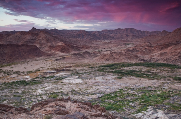
View over the !Gariep River and a dry riverbed meandering out of the mountains of Namibia. We were lucky enough to experience an evening of thunderstorms in this harsh and arid desert environment.
Channel-faffing set us back a few kilometres for a couple of days running, which meant we needed to up our game for the last two days in order to make Noordoewer and a welcome day off. Luckily the last stretch from Henkriesmond has been a real gem and (mostly) a pleasure to paddle. Getting up early, paddling in the morning coolness (and thankfully it HAS started to cool off now), and seeing the soft morning light on this rugged mountainous landscape has been spectacular.
The last day into Noordoewer was particularly brutal though, with the team clocking up over 60km, including a carefully calculated run down the side of a 5m weir, and two diatom samples.
Seven weeks living on a river and well over 1800km paddled makes one a little tougher, but we were still very glad to see the grassy lawns of Camp Provenance in the glare of the late afternoon sun.
The kayaks have handled the channel-bashing remarkably well, although the rear of James’s boat has continued to take on water (from the Orania weir debacle – read earlier post) against his best and repeated efforts to find and seal the leak. Candlewax – his latest attempt – seems to be doing the trick though. Other incidents have included Sam’s rudder cable snapping above Ritchie and James banging in the nose of his boat whilst negotiating the side channel on that 5m weir, but both have been successfully repaired.
Right now we’re doing the last resupply for the run to the coast and have started discussing reintegration into society. Not sure whether society will want us back…but maybe if we wash and shave…?
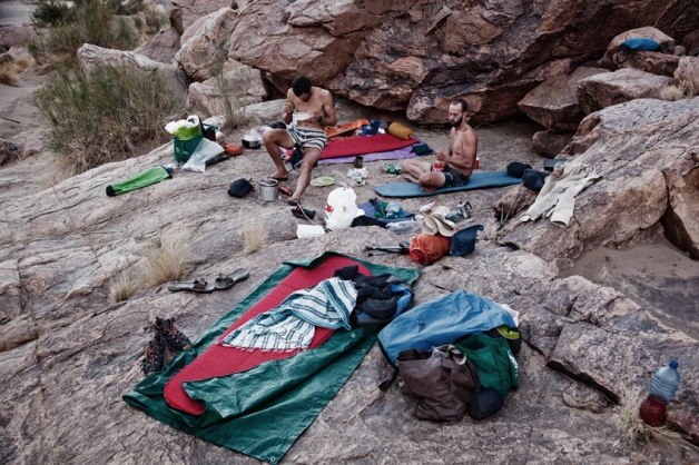
Hey, do the Khoisan still inhabit the !Gariep River valley? No no, that’s Sam Jack and Ian Durbach, two Englishmen from Cape Town.
This last stretch will take us through the arid Richtersveld landscape and out onto the coastal plain. It won’t be a doddle (there are several noteworthy rapids, long flat stretches, headwinds etc), but it feels like the home stretch and we’re excited and a little nervous to be nearing the end of such a grand adventure.
The next time you hear from us we will hopefully have reached the sea!

